Overview
An island of birds, Miyakejima Island is most famous for its Mt. Oyama volcanic eruptions. Home also to scores of unique natural formations and outdoor activities, the island features the unique Shiitori Shrine and its submerged torii gate, the Miyake Nature Centre and its bird watching facilities, the infamous Ako Lava Flow Trail built by residents over the remains of one eruption as well as the beautiful Tairo Pond.
Shiitori Shrine
Like much of the island, the power of its volcano is evident with Shiitori Shrine. The lava flow from an eruption in 2000 swallowed up the torii gate of the shrine leaving only the top bar exposed as well as the shrine roof. Nearby stands the main shrine but the torii and roof remains are a surreal sight.
Ten minutes by car from Miyakejima Airport or Miike Port.
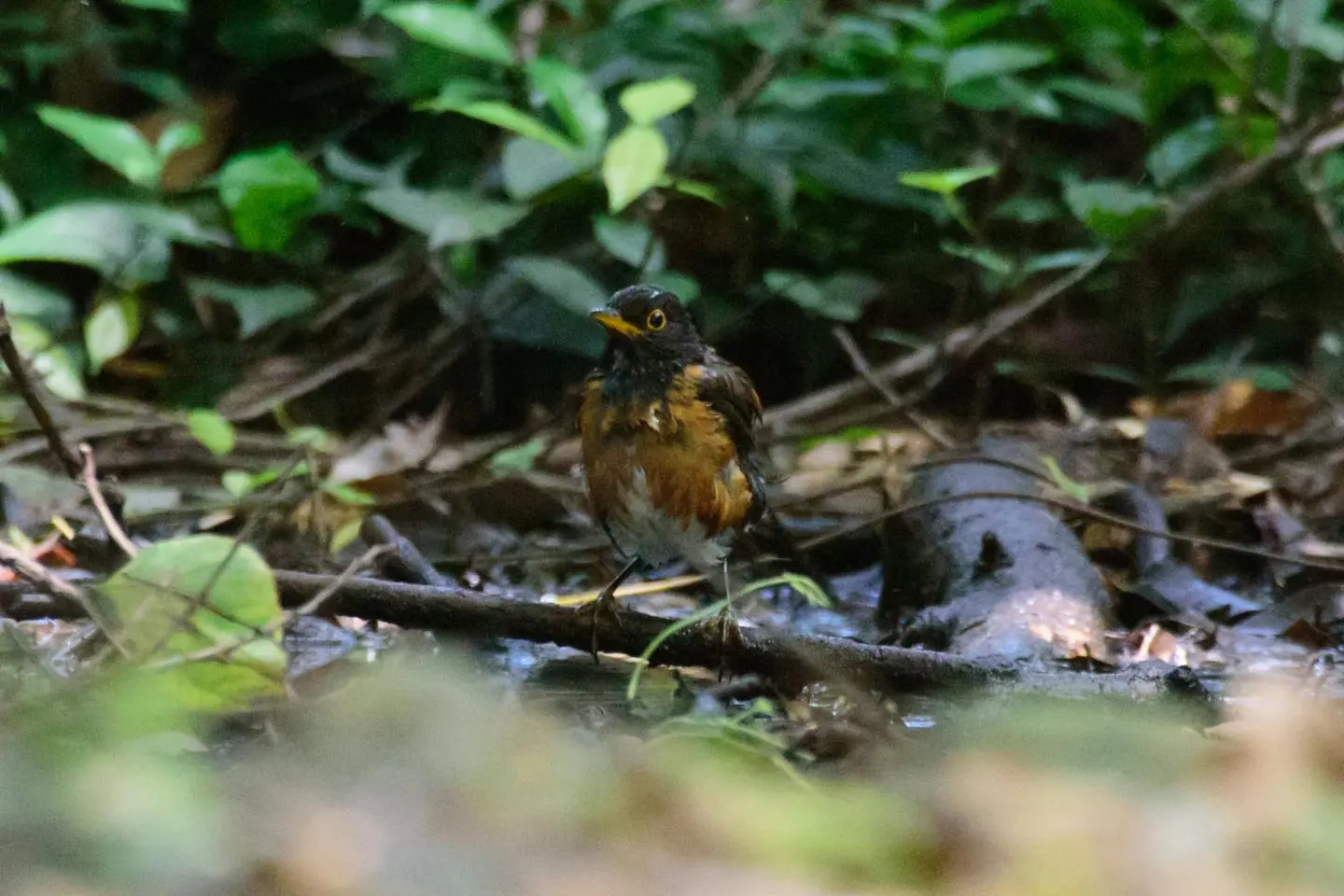
Miyake Nature Centre Akokakko-kan
The island is famous for its birds and in the south lies the Miyake Nature Centre Akokakko-kan. A centre for bird watching and research, it's named after the island's representative National Treasure, the Izu thrush species and is home to an observation space as well as telescopes.
Seven minutes by car from Miyakejima Airport or ten minutes from Miike Port.
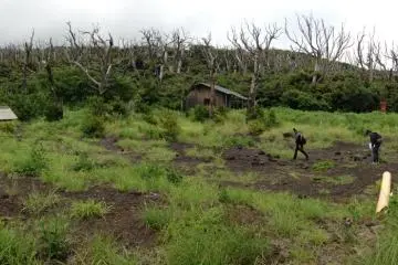
Ako Lava Flow Trail
Found on the western side of the island, the Ako Lava Flow Trail is a walkway built by residents in 2007. Underneath lies pitch black volcanic rock, a result of an eruption in 1983. The contrast between the lush greenery of the island's flora and the absorbing darkness of a volcano is fascinating.
Twenty minutes by car from Miyakejima Airport or Miike Port.
Tairo Pond
Said to have been formed two thousand years ago, Tairo Pond is an unusually rare thirty metre deep freshwater pond right by the ocean. Hundreds of species of wild birds inhabit the forest surrounding the pond. Be on the lookout for the six hundred year old 'Lost Chinquapin Tree'.
Eight minutes from Miyakejima Airport or eleven minutes from Miike Port.


/139.5178185,34.0788424,9/397x132?access_token=pk.eyJ1IjoiamFwYW50cmF2ZWxtYXBzIiwiYSI6ImNqbXBtOXYxbDB5Z3ozbHFrazJuYWMwOGYifQ.v15fy_mcFWtgopmz8PhwqA)