

The Koburi Pass in Saitama is often still considered a little insider tip for hikers. Although it runs through an extensive natural area, this pass is often overlooked in guidebooks for hiking routes in Japan. Of course, the same can be said about numerous other hiking trails here in the country, because there are simply too many to really list them all. However, together with our friend Ai we took the train towards Agano station in the city of Hanno for a trip that began to escalate during the evening.
Arriving in Agano and the search for the Koburi Pass
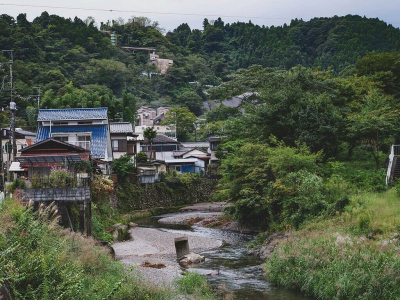
The journey to Agano station was relatively uncomplicated. You get on the train in Ikebukuro, then you change trains in Hanno. From there, it is not too far to Agano. The journey is quite cheap and it takes less than 1.5 hours to get there. The area around Agano station is a tranquil little place surrounded by mountains.
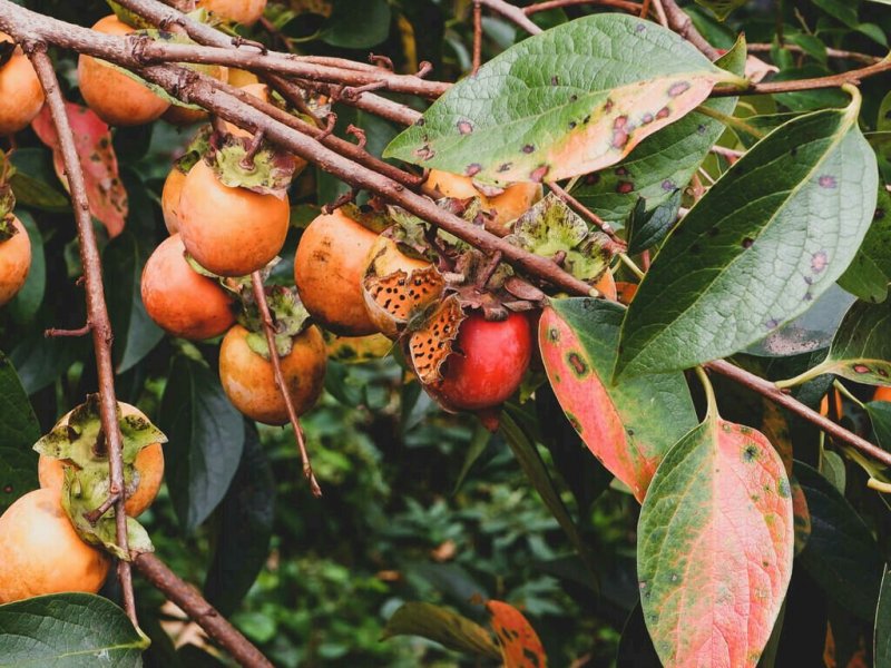
So we got off the train and began searching the way to the Koburi Pass. Along the road, we found a map of the area, which we used for orientation. At the same time, my wife Susann used the time to take the first photos, e.g. of an orange butterfly in the middle of a persimmon tree with fruits of the same colour.


After a while, we finally found the proper starting point of our hiking trail, but before we really set off, I got a bottle of tea from what was probably the last vending machine we would see all day. We had some supplies with us, but you shouldn't underestimate the effort of such a tour, especially if you are doing it for the first time.
When we wanted to pack the bottle into our backpack, we were surprised by the never-ending signal tone from the vending machine and a closer look told us what happened: On the display "7777" appeared flashing and we could choose a free drink. Susann and Ai saw for the first time, that you can get something for free at these machines. This was the third time I had such luck. Of course we did not say no, quickly pressed the button for a soda and then continued on our way up the mountain. So we had a promising start to our hike on the Koburi Pass.
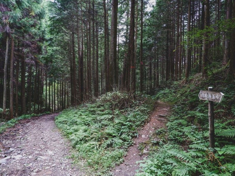
At the beginning, the path was still relatively unspectacular. Although we were surrounded by beautiful nature left and right, and could make out small, clear streams, the path itself was still an asphalt road. Susann found out about the Koburi Pass in advance in her search for a suitable hiking trail and had also found a detailed description of the route. The problem with these trails is often that, although they have signs along the way, they are not always marked with the name of the trail, but describe individual intermediate stops. But if you don't know exactly, what the next destination is, you can get lost.


We planned to walk from Agano Station along the path to the other side to Higashi Agano station. However, for a long time there were no signs indicating the way to Higashi Agano station, but only to Agano station or individual viewpoints along the way. Therefore, it is always good to do a little preparation before a day hike. Especially on less well-known hiking routes, it is rarely the case, that you meet other hikers, who you can ask for directions.
A relaxing hike and delicious bento
Finally, we could leave the asphalt and were immediately surprised with a warning. A sign told us to watch out for the mud, because there are viruses in it. So don't touch the footwear and clean it a little, when you leave.
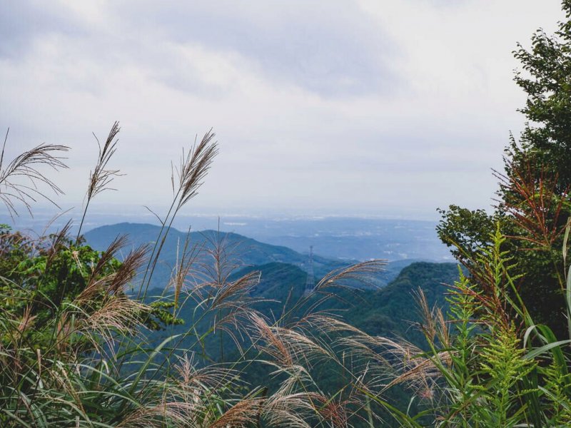
We went up the mountain over narrow paths, numerous branches and slippery stones - just as you would imagine on a decent hike. Sometimes the path branched out and we had to orientate ourselves with the help of the signs. As already written, we hardly met any other hikers on this trip, so we were able to enjoy the peace and quiet all by ourselves for the most part.
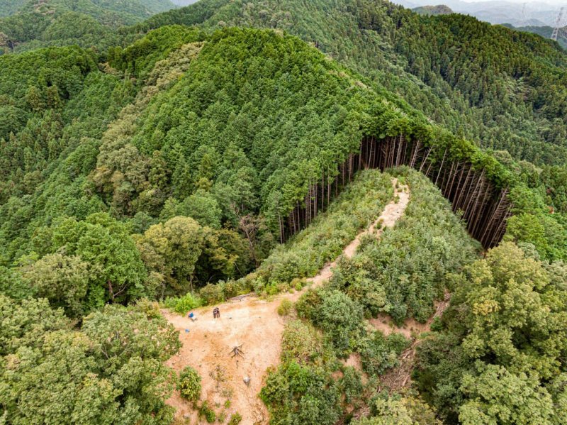
I myself was also looking for a suitable place to fly our drone. We had done a little research on the drone rules in Saitama beforehand, and since Koburi Pass is managed by the prefecture itself, the general rules were pretty clear and apart from the MLIT rules, we had no restrictions. I also wrote a detailed article on the rules of drone flying in Japan.
On our search for a suitable place for a break, we discovered a small udon restaurant with a great view over the valley. It was located on a mountain road, that was also relatively well frequented by cars. Nevertheless, Ai had taken the trouble to prepare fresh bento for the three of us beforehand, so we looked for another place to take a break. There was also supposed to be a small shrine here, which we also wanted to see.


There was a big map of the surrounding nature park with all its paths. Besides the main road, there were other narrower paths up the mountain and back into the forest. This made it a bit difficult to find the right way. So we decided to take one of the paths, that went up, because we suspected the shrine to being located close by.
I ran up the steep slope and thought, I could make out a building through the tall trees. Was this perhaps the shrine we were looking for? No, it was a gigantic dead white tree, but it still looked great. At the same time, we found a small area at the edge of the mountain, where we could take our break. So we sat down, unpacked our fresh bento and enjoyed the view and the food.
After we finished eating, we unpacked the drone and let it fly high above the valley. The sky was a little cloudy, so it was a little hard to get really nice photos, but videos taken from this height are always fascinating.
After a 20-minute flight over the Koburi Pass, we retrieved the drone and packed our things to set off again. We still hadn't found the shrine and since the path up here didn't go any further, we marched back down the steep slope.
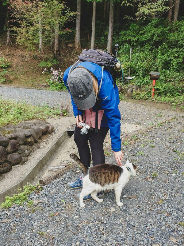
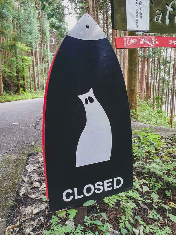
But before we reached the shrine, we were distracted by a sign with a cat on the side of the road that said "Closed". Down the steep road was a café and a cat, which immediately caught the attention of Ai and Susann. On the driveway, we had to duck our heads because there was a gigantic spider web with a spider in the centre. This would not be the last spider, who wanted to block our way for today.


We followed the main asphalt road for a while and found a new sign pointing the way to the shrine. The shrine itself was in the middle of the forest. We looked around a bit, paid our respects and then left.
We found another spot on a high plain, where we could launch the drone and Ai captured us and the surroundings around Koburi Pass. We left the forest and reached a small farming village, through which we had to pass. On the other side, we entered the forest again and according to the signs, we would soon reach Higashi Agano station and thus the end of Koburi Pass. We followed a few more signs and were already looking forward to the return journey to Tokyo, where we actually wanted to invite Ai to dinner as a thank you for the bento, but everything turned out different than expected.
This quickly escalated
All of a sudden, we were standing at a sign pointing in two different directions. Neither of them had Higashi Agano written on it. Where should we go now? Did we miss a sign? To be on the safe side, we walked back again and realised, that we hadn't missed a turn.
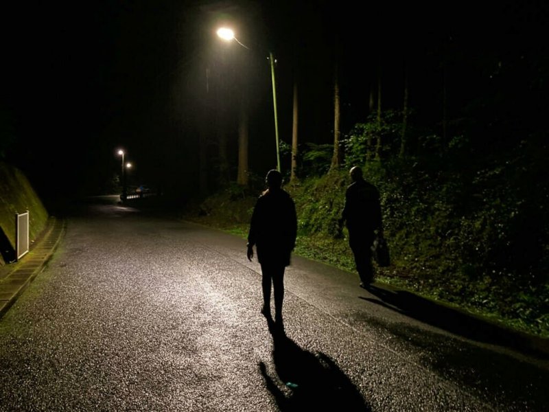
Darkness had already fallen and we used the lights on our smartphones to see, where we were going. Luckily, I had a strong spare battery with me and so two of our phones were fully charged. Ai and Susann tried to find our position using map apps and a way to get out of the forest the fastest.
There were not many paths marked, but a little further north on the other side of a narrow stream there should have been a road leading up to the railway station. We tried our luck and I went ahead. It was dark and the path kept turning from left to right.


After some time we could hear the water and see lights from the road on the other side. Unfortunately, shortly afterwards the path headed deeper into the forest and up the mountain again, so we decided to go back towards the farm village. So up the hill again, always watching our steps. This was not how we had imagined our hike on the Koburi Pass.
As I went ahead myself, it was also not uncommon for me to run into a spider web, almost blindly freeing myself. It was a strange feeling and we just hoped that we wouldn't miss the last train towards Tokyo. Near the farm village we found a small map, but since the position was wrong, it was hard to orientate ourselves. The GPS wasn't very accurate here either, so we followed a sign saying "road for vehicles".
Again, we reached the end of the road and suddenly we were standing on the property of a residential house in the middle of nowhere. Ai suggested that we ask for directions. After a few shouts, the owner of the house came out and was a little confused. Ai wanted him to tell us how to get to the main road, but he kept telling us that it wouldn't work and that we would have to walk along the hiking trail to Higashi Agano station.
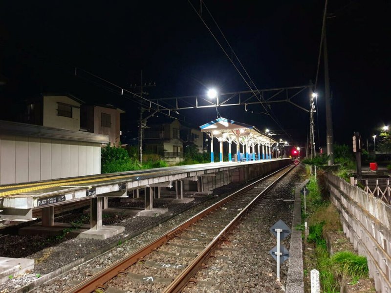
We trusted the man and set off again into the darkness of the forest until, after a few metres, a gigantic spider web blocked our way again. I looked for a long stick and carefully cleared the way. I ran ahead, swinging the stick back and forth in front of me, so that we wouldn't run into one of these spider webs again. It must have taken another 45 minutes before we finally left the forest and had solid ground under our feet again. Civilisation! We followed the road until we finally reached the illuminated Higashi Agano station and had officially left the Koburi Pass behind us.


From Higashi Agano back to Tokyo
We were really exhausted. Actually, the stated duration was more like 3 to 5 hours if you walk along the entire Koburi Pass, but we ended up walking for 9 hours. Our "signature move" on this hike was definitely the crab walk. We reached Ikebukuro, tired but happy, and quickly realised that many restaurants were already closed. Moreover, all of us could no longer hide our tiredness, so we decided to arrange to eat together another time. We said goodbye and made our way home.
Do not rely on technology and signs alone!
We didn't expect it to escalate like this in the end. We had hoped to have a relaxed hike with Ai and to end it together with a nice meal. But things turned out different than planned and we quickly realised once again that it is important not to rely solely on apps or signs. It is important to get a feel for the surroundings. It's also best to take a compass and, of course, enough food and flashlights in case something unexpected happens.
Hiking along the Koburi Pass was a great experience, but also one we wouldn't want to do again so soon. In any case, we hope that Ai will not be put off by this and that, as soon as we invite her for another relaxed hike, she will still want to join us.
You can find a German version of this article on my personal Blog.


-togo-park-104992.jpg "The Beautiful (and Steep) Togo Park")


")


My cellphone is quite unreliable when in thick woodland or higher altitudes (well, more like all the time) so I always carry a compass with me and study Google Maps the night before. That way I can more easily figure out my way back towards a road in case I start to feel lost.
Especially useful because I like to explore down any old, overgrown trails I come across!
Glad you found your way back to civilization, I don't think I'd do so well stumbling through spider webs after dark!