

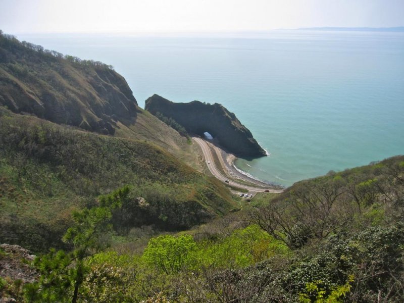
Located about 30 minutes south of Niigata City by car, Mt. Kakuda, along with it’s taller neighbor Mt. Yahiko, is a beautiful and integral part of Niigata’s landscape. It’s peak tops out at 473m in elevation. Being from Colorado I’m quite fond of blowing a dismissive breath through my lips and saying, “My house is higher than that.” That’s perfectly true, but no mountain in Colorado can be hiked from sea to summit. Several hiking trails lead to the summit of Mt. Kakuda, but the steepest, most difficult (and therefore the most fun) trail starts on Kakuda Beach just below the Cape Kakuda Lighthouse. The route is about 5km in length and despite being steep for the first half of the climb, I found it to be a fun, easy hike. Sakura in full bloom on my third ascent of Kakuda at the end of April served to enhance the already stunning scenery even further.
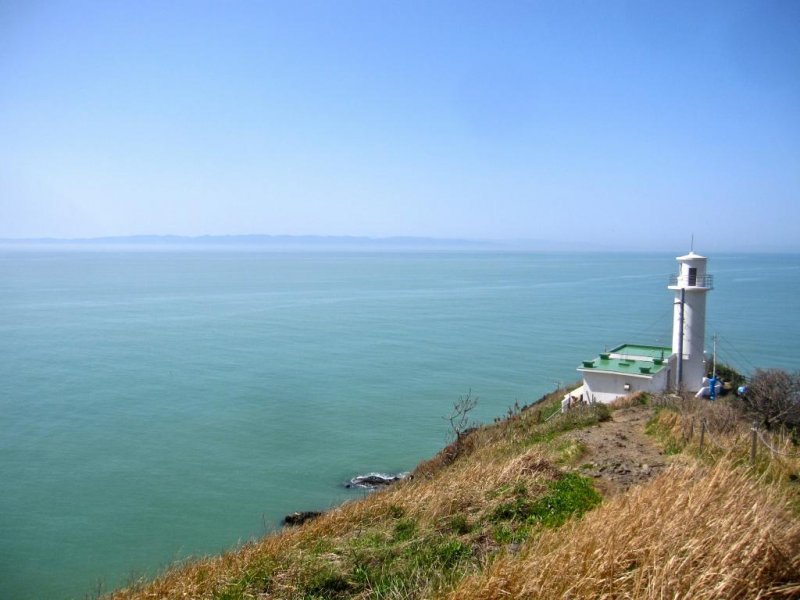
After parking my car in the parking lot closest to the trailhead (at Kakuda Beach Daiichi Parking lot, an official swimming area and campground), I walked down to the beach and put my feet into the water. Sea to summit means sea to summit. The ascent up the cliff bounding the south end of the beach, via some steep concrete stairs, takes one to the Cape Kakuda Lighthouse and an excellent view over Kakuda Beach, the sea cliffs to the south and across the blue-green Sea of Japan to Sado Island in the west. It is a fabulous place to take in the view and watch the sunset. If you need a place to set the mood for a romantic evening with your wife or girlfriend, you’d be hard pressed to find a better spot than this.
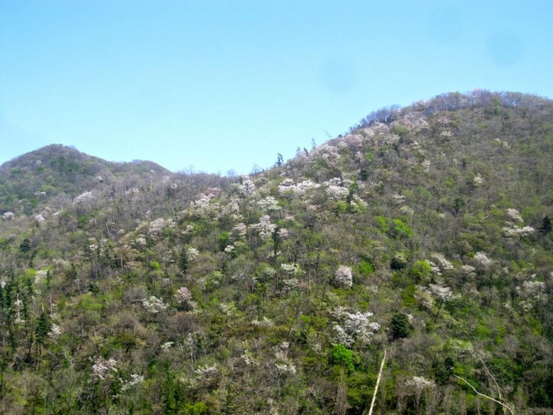
From the lighthouse the climb continues, almost straight up over three sakura covered false-summits. The beautiful white and pink flowers and fresh spring green leaves on the mountain sides all around had me stopping to take picture after picture. A flat and clear area at the top of the first false-summit affords one a functionally unobstructed 360º view. It also allows a moment to breathe after the steep climb from the lighthouse. The path from here across the next two false summits is much easier than the steep first climb and one can catch their breath and enjoy looking down on the lighthouse.
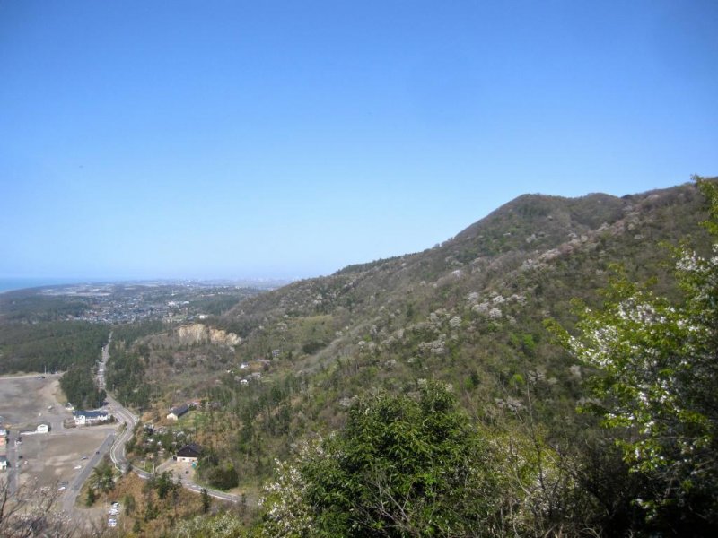
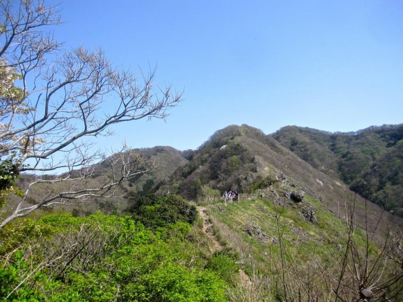
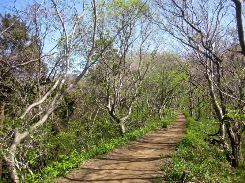
After descending from the third false-summit, the trail becomes rocky and steep as it follows a ridge line up to the mountain’s upper slopes. It gets steeper the higher up you go, but the lack of tall vegetation means the view gets more and more expansive. Take it in while you can because it all but goes away when you reach the woods at the top of the slope. Once you reach the woods the steepest part of the climb is over. The trail here is much gentler. Purple flowers, butterflies, birds and other wildlife are everywhere. Keep a sharp eye out, you never know what you’ll see.
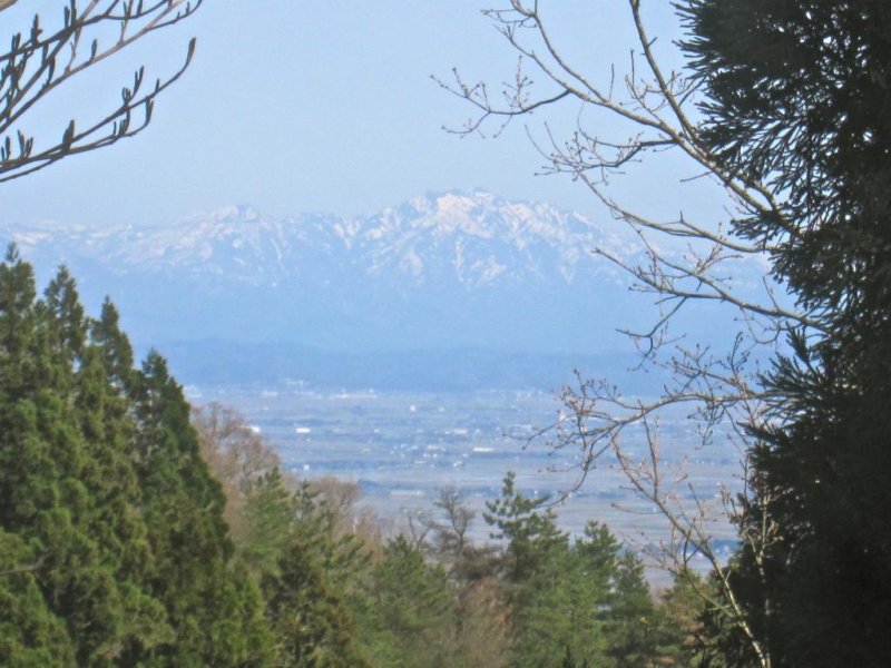
The trail through the woods runs inland in an easterly direction until it reaches the main “spine” of Mt. Kakuda where it turns left and heads for the summit. The forest here is quite thick but there are enough gaps in the trees on both sides to show you (but maybe not your camera) views of the Sea of Japan on the west and the Iiderenpo Mountains to the east. Another kilometer or so of hiking will take you, at last to the summit of Mt. Kakuda, a park-like open area ringed by mixed pine, deciduous and sakura trees. There are benches and picnic tables where one can enjoy a bento and a breather, and a small hut where one can get out of the sun.
Break over its time to turn around and go back the way you came. Take care going down, descending the steeper bits can be more difficult than climbing them. I managed to hike Mt. Kakuda in about four hours including lunch and taking pictures. Starting your hike later and timing your descent to coincide with the sunset can make for some breathtaking views. So, do want to have an easy adventure today?


")
")


