The ever popular Mount Takao is a long established favorite amongst the hoards of Tokyoites looking to escape the chaos of the bustling metropolis for several hours.
Tucked deep into Hachioji city’s western corner, this mountain offers numerous attractions including the impressive Yakuo-in Temple, some great views and many enjoyable hiking courses all within an hour’s commute from central Tokyo.
For the casual day tripper, there are several easy hiking courses leading to the top of this mountain, each taking about three hours to complete. Additionally, there are some longer courses suited to the more dedicated hiker including the popular Takao to Mount Jimba route. This 7-8 hour course runs westwards to Mount Jimba where it is possible to return to Takaosanguchi Station by bus.
The course
Although both of the above represent two good options, an interesting alternative involves hiking from Mount Takao to Lake Sagami.
Whilst taking in many of the popular sights, this course offers the chance to escape Takao’s often crowded paths later on in the hike. For anyone wanting something a little more challenging than the usual return route from Takao but not quite willing to commit to the long Jimba hike, this could be the one for you!
Some of this hike's highlights include traversing over Mount Kobotoke-Shiroyama, passing through the scenic Kobotoke Gorge then on to Mount Kagenobu where you can experience some amazing panoramic views before heading down to the relaxing shores of Lake Sagami.
Access
This hike conveniently begins in front of Takaosanguchi Station on the Keio Line whilst it ends very close to Sagamiko Station on the JR Chuo Line, which runs directly into central Tokyo.
To Mount Takao
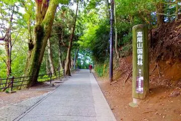
From Takaosanguchi Station, turn right and follow the signs until you reach an open area in front of the cable car station. To reach the peak it`s possible to take one of three routes. Opting for the Omotesando route, this trail zigzags along the mountain, passing through the impressive Yakuo-in Temple before reaching the top of Takao.
When ascending this path you’ll soon realize this mountain is a very religious place from the endless rows of statues and monuments present. Interestingly, Takao has been home to the Shingon Sect of Buddhism since 744.
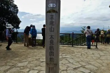
After battling the crowds for about 90 minutes you should reach the peak enabling you to get your first panoramic views of the day. This point also marks the beginning of your westward journey by following the signs for Kobotoke-Shiroyama (小仏峠-城山).
Heading westwards
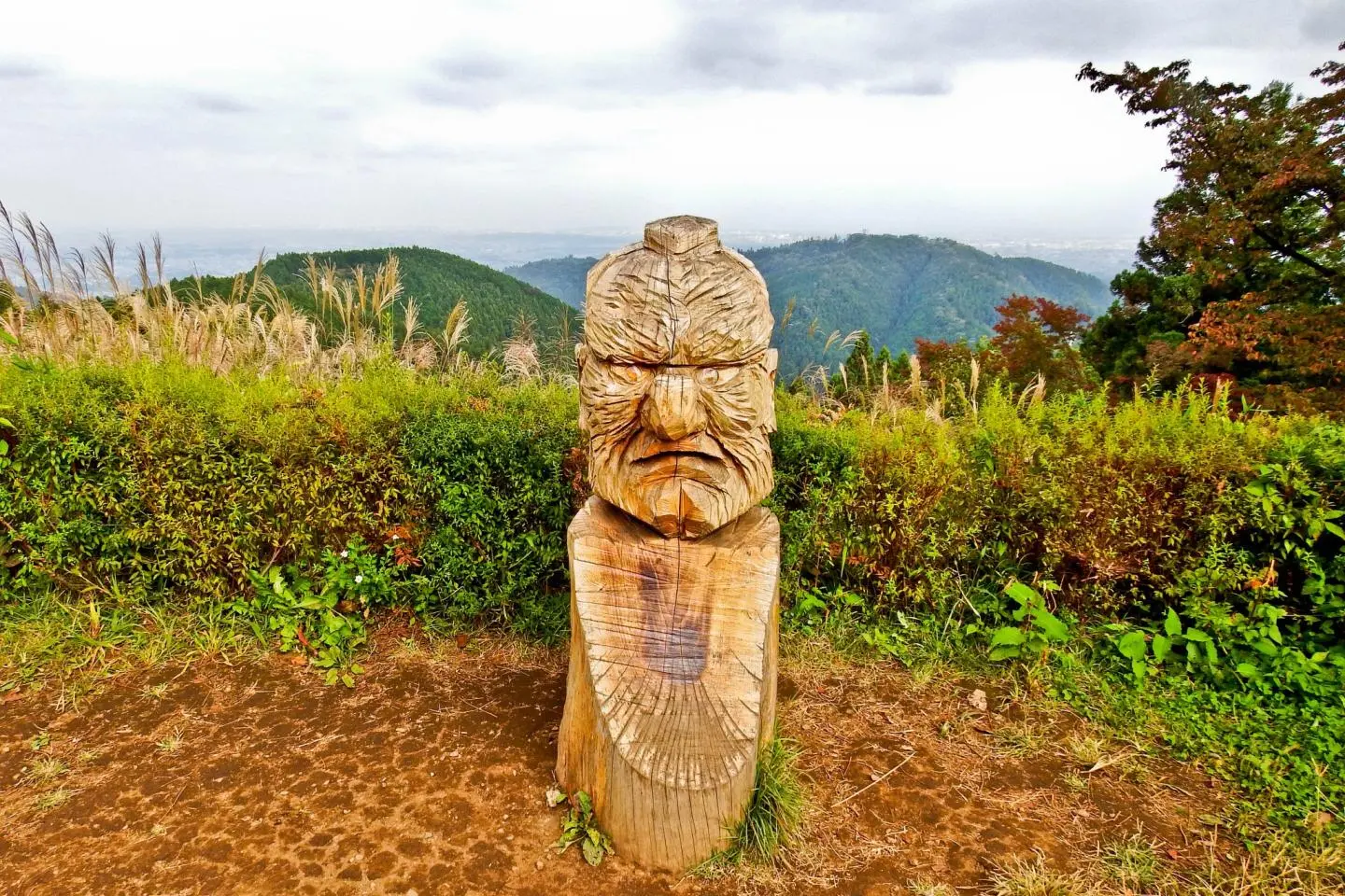
The hour`s hike to Kobotoke-Shiroyama ascends along a path with a seemingly endless series of wooden stairs before reaching a large rest area where it is possible to see the now distant Mount Takao. Interestingly, there is a large carving of a Tengu, (mountain god) placed next to the sign marking this peak.
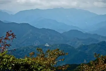
Although it is possible to descend directly down to Lake Sagami from here, a worthwhile detour involves making an 80 minute return journey to Mount Kagenobu, (景信山). This picturesque route passes through rugged forest before leading out onto an exposed ridge line which is partially devoid of vegetation. With the peak of Mount Kagenobu standing over 100 meters taller than Takao, it is possible to peer down at the summit as well as the narrow ridge line that you`ve just traversed.
The final descent
Upon returning to Kobotoke-Shiroyama, you are now ready for the final descent to Lake Sagami. Following the signs for Benten Bridge (弁天橋), you will descend along a narrow trail passing several small Jizo, (statues) before reaching a small residential area containing some rice fields. Continue following the signs for this bridge which will soon lead you back into another forest.
When traversing through here, you will notice a waterfall before reaching an observation point where it is possible to see the bridge in the distance. Situated in a deep valley, Benten Bridge makes an impressive sight with its bright red contrasting perfectly against the forest’s lush greenery and the river`s deep blue and emerald green colors.
After crossing this bridge, the path will then form into a main road running parallel to the riverbank before reaching a very distinctive large dam. Interestingly, Lake Sagami is in fact a manmade reservoir! Despite this fact however, it is a popular recreation spot for many water sports including kayaking and sailing.
To finish this hike, simply continue heading eastwards along the shoreline for about 20 minutes where you’ll reach Sagamiko Park; a short walk away from the station. This pleasant little spot provides the perfect backdrop for ending the day’s adventure whilst gazing out into the distance at the mountains and clouds looming over the horizon


/139.27011548658,35.63275209616,9/397x132?access_token=pk.eyJ1IjoiamFwYW50cmF2ZWxtYXBzIiwiYSI6ImNqbXBtOXYxbDB5Z3ozbHFrazJuYWMwOGYifQ.v15fy_mcFWtgopmz8PhwqA)