
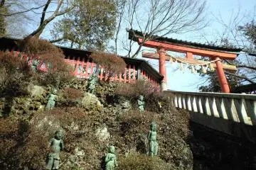
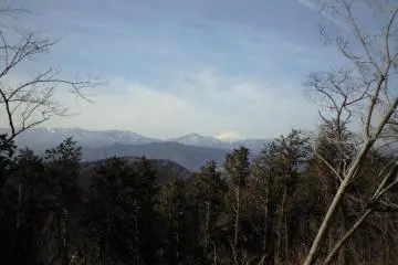
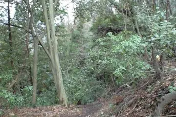
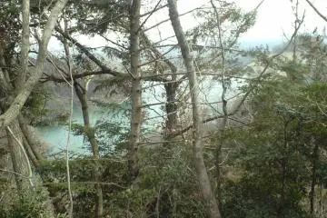
One of the things that I love the most about Japan is the combination of culture and nature. Most people that travel here don't have a chance to get out of the cities because of the language and information barriers. However this path is an easy day trip out of Tokyo and can be easily walked while allowing the traveler to enjoy a glimpse of some of Asia's broad-leaf evergreen forest (evergreen oak trees!) along with views of lake Tsukui, Misawa and Otarumi passes, as well as other elements of Japan's natural beauty and exquisite cultural heritage in the form of the Takao San World Heritage Site, which complete with ancient and beautiful Buddhist temples and Shinto shrines on top of Takao mountain with beautiful panoramic views the surrounding mountains and even Mt. Fuji in the distance.
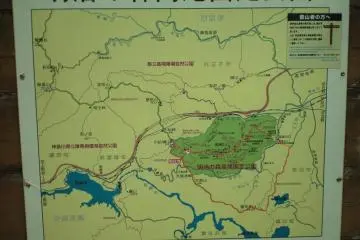
The Lake path is 16.2 km (a little over 10 miles) and is part of a regional network of trails collectively known as the Kanto Fureai no Michi (pronounced like Kantoe foo-leh-ai no meechee), which covers the provinces of Tokyo metropolis, Saitama, Kanagawa, Chiba, etc.. It is divided into about 144 sections that can be taken one or two a day. This path is the southernmost section in Tokyo and is the most accessible because it loops back to its starting point at the famous and easily accessible Takao San (a world heritage site all on its own).
To get there you can take a direct train from the Keio line starting at Shinjuku station in Tokyo which costs 370 yen and takes about 50 minutes or a JR train from Tokyo station, then transfer for one stop to the Keio line at Takao San station (don’t be fooled by the name you are not there yet!) for Takao San Guchi station which costs 1010 yen and takes one hour and 20 minutes. These trains leave regularly. The Keio line has a direct train about every 20 minutes and the JR train from Tokyo has a train at least once per hour. Coming back is just as easy. Just repeat the above process in reverse.
Once at Takao San Guchi station make your way to the information center, a little building to the left the station entrance and across the street. Here ask the friendly older gentlemen with limited English ability for a map by saying “MeeZooMee No Meechee Chizu Onegai Shimasu.” Or show them a piece of paper with this written on it “湖の道” (cut and paste then print is also good, it doesn’t have to be hand written). They will then furnish you with a nice trail map (in Japanese only) and you will be ready to begin your trek through the mountains.

/139.27006340027,35.6309817482,9/397x132?access_token=pk.eyJ1IjoiamFwYW50cmF2ZWxtYXBzIiwiYSI6ImNqbXBtOXYxbDB5Z3ozbHFrazJuYWMwOGYifQ.v15fy_mcFWtgopmz8PhwqA)